New York Subway - Map and route planner by Zuti 1.0
Paid Version
Publisher Description
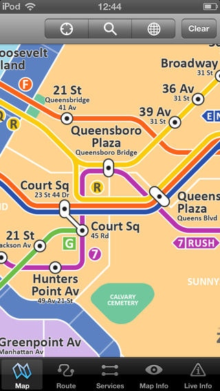
This new app is fantastic for getting around New York using the subway. It contains a beautiful map and some totally unique features. &# KEY FEATURES &# &# Simple, fast and easy to use. &# Designed for the first time visitor and experienced commuter. &# Unique "Travel Explorer" feature provides a view of travel times and distances from any location on the map. &# Professionally drawn colourful and clear map with geographical features and places of interest. &# Planned route animates on the map. &# Saves and recalls favourite and recent journeys. &# Take me home feature. &# Online street map integration ( internet connection required). &# Services can be turned on or off, routing around problems. &# Works in both landscape and portrait modes. &# Easily locates your nearest transport stop. &# Places of interest, parks etc are built in to the application. &# View live service advisories (internet connection required). &# OVERVIEW &# The New York Subway - Map and route planner by Zuti makes it easy to travel in and around New York using the subway, Staten Island railway, Staten Island ferry and JFK Airtrain. The application contains a professionally drawn map and route planner with many unique features. The map provides a simple and colourful view of the city transport services with the ability to flip to an online street map view when an internet connection is available. This way the user can view the online map when above ground and the transport map and route planning is still fully functional underground or anywhere there is no internet connectivity. This provides the best of both worlds, the transport map and route planning anytime, anywhere and online street maps and search when a connection is available. &# TRAVEL EXPLORER &# The unique travel explorer feature provides a view of travel times using transport and on foot and distances from any location on the map. This is helpful for getting a sense of scale and connectivity of the transport system and can provide some interesting results. For example is it quicker to use the subway to go from Harlem/7 Avenue to 155 Street/8 Avenue or is it quicker on foot? (Hint, the quickest route will keep you fitter). No other application makes it so easy to get around on the subway and allow you to make travel decisions based on the actual distances and estimated travel times on foot. &# ROUTING &# The application does not require an internet connection and will always be available to display a clear and detailed view of the city transport system, plus list and animate the optimum route for your journey. Provides the fastest route calculations of any mobile routing application (virtually instantaneous) using actual published journey times with the ability to select the quickest route or the route with the least changes. Comprehensive details of your planned route are provided, including direction , towards and service frequency information (not available on any other offline journey planner) for example Take the 3 7th Av Express line (Southbound) towards New Lots Av for 17 mins (7 stops). Service runs every 5 minutes which is essential when finding the correct platform and direction. Also given are alternatives for each leg of the journey. &# NO INTERNET CONNECTION REQUIRED &# The map and routing do not require an internet connection and you will not be charged data connection fees. This means the application saves on battery power and runs perfectly underground, on an aeroplane, etc. For international visitors to a city who have data roaming turned off this is an ideal solution. &# LIVE INFO &# When an internet connection is available, optional "Live Information" on the current state of the transport services can be viewed allowing you to plan your journeys in advance and avoid any potential delays. Unique to this application is the ability to turn off services that are out of action and automatically calculate an alternative route.
Requires iOS 4.3 or later. Compatible with iPhone, iPad, and iPod touch.
About New York Subway - Map and route planner by Zuti
New York Subway - Map and route planner by Zuti is a paid app for iOS published in the Recreation list of apps, part of Home & Hobby.
The company that develops New York Subway - Map and route planner by Zuti is Visual IT Ltd. The latest version released by its developer is 1.0.
To install New York Subway - Map and route planner by Zuti on your iOS device, just click the green Continue To App button above to start the installation process. The app is listed on our website since 2013-07-06 and was downloaded 23 times. We have already checked if the download link is safe, however for your own protection we recommend that you scan the downloaded app with your antivirus. Your antivirus may detect the New York Subway - Map and route planner by Zuti as malware if the download link is broken.
How to install New York Subway - Map and route planner by Zuti on your iOS device:
- Click on the Continue To App button on our website. This will redirect you to the App Store.
- Once the New York Subway - Map and route planner by Zuti is shown in the iTunes listing of your iOS device, you can start its download and installation. Tap on the GET button to the right of the app to start downloading it.
- If you are not logged-in the iOS appstore app, you'll be prompted for your your Apple ID and/or password.
- After New York Subway - Map and route planner by Zuti is downloaded, you'll see an INSTALL button to the right. Tap on it to start the actual installation of the iOS app.
- Once installation is finished you can tap on the OPEN button to start it. Its icon will also be added to your device home screen.
